|
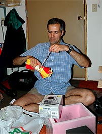
SABLE-1 Southern Alberta Balloon Launch Experiments Tony, a teacher from Hanna, Alberta, contacted me in October of 2005 after finding the BEAR Web Site and that it was a group, also in Alberta, as he wanted to launch a high altitude balloon and do some aerial photography with his students and was looking for help to get started as this was all new to him. Tony also knew little about amateur radio and nothing about APRS needed to track a balloon so James, VE6SRV, was involved and the two of us have been helping Tony get up to speed since last October. Tony had already scheduled and made arrangements for a balloon launch on May 20th, 2006, so there was little time for him to learn and do everything that needed to be done by himself, including studying for and getting an amateur radio license, so James and I offered to lend him an APRS tracker and I also offered to help prepare a digital camera for him. The tracker was assembled using BEAR's GPS receiver and a Pocket Tracker that James had and the camera is a Canon PowerShot S200 Digital IXUS V2 that Tony purchased and needs a way to be triggered to take an image every few minutes. April 14th, 2006 March was spent trying to resolve an unexpected problem with Tony's camera after it was modified. Read all about My Canon Camera Modification & Trying to Deal with Canon's Famous E18 Lens Error which left Tony with no camera for his balloon flight and no time to try and modify another to take photo's automatically so Tony did what was originally considered which was to simply purchase one of the more expensive cameras which have a built-in timer for this function, like the new Nikon P2 camera he now has. |
|
|
 |
 |
|
|
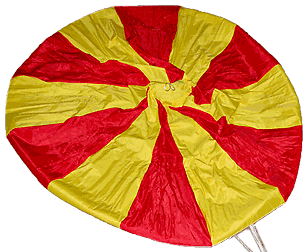
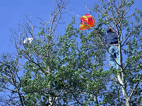
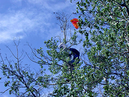
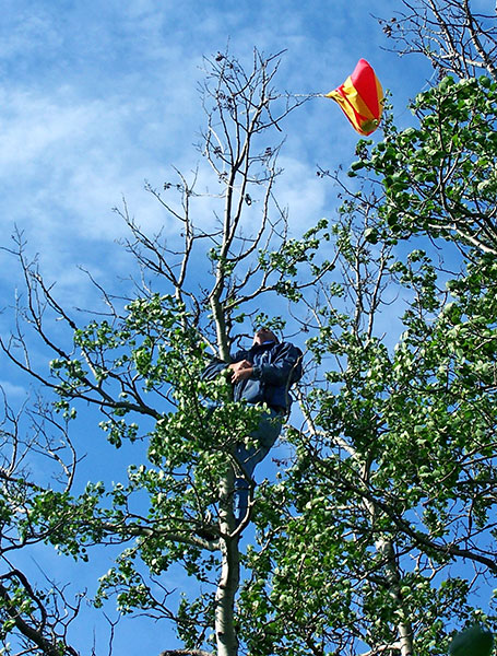
Tony now also has this bright, colourful, new parachute to use that his grade 8 class girls have been busy sewing for him. |
||
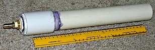 |
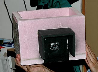
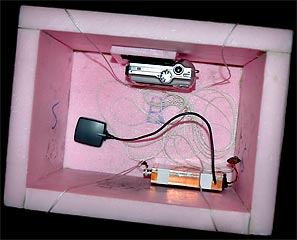
Tony has finished making this balloon filling adapter and has been studying for his amateur radio license, which he recently received. Congratulations Tony, VA6TNY |
|
|
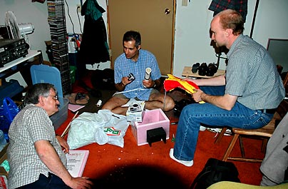
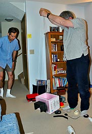
And the APRS Tracker we promised to lend Tony is now finished....... |
||
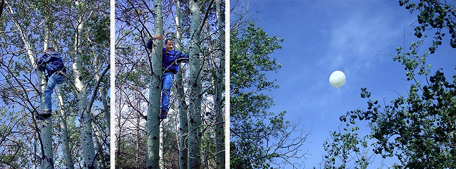
| and Construction of the Tracker Antenna was completed the week before the launch. |
||
|
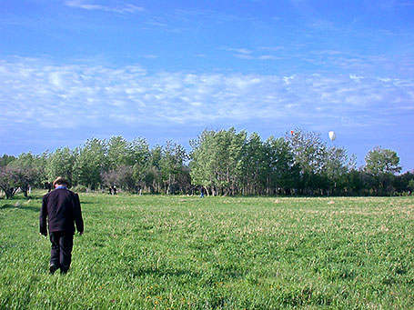
May 19th, 2006 Besides James & myself, Curtis, VE6AEW, & Carl, VE6GGG, also accepted Tony's offer of a place to stay and after travelling to Hanna on Friday afternoon to help launch and recover SABLE-1 the next morning we all made ourselves at home and spent the evening visiting and making last minute preparations.
|

|
Trying to handle the balloon in the wind was worse |
||||
|
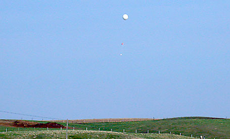
The only choice now was to simply launch from where I was, but the tracker antenna had become tangled in the payload and parachute support lines so we had to watch as the wind smashed the balloon into the gravel even harder a few more times as we tried to untangle the antenna in a state of panic. This short delay ended up almost perfectly synchronizing payload camera photos to the launch time and . . .
However data transmissions suddenly stopped being received from the balloon shortly after it disappeared from view, so we quickly prepared to give chase to hopefully regain sight of and follow it to where ever it landed. But someone on a nearby hill top then reported watching it become tangled up in trees a few miles away and payload
camera photos later showed what had happened while the balloon was out of sight and why tracking data suddenly stopped being received.
|
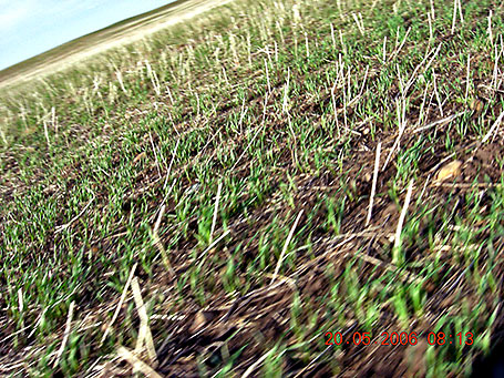
After disappearing from view at 8:11 the balloon continued to travel quickly in the 40 km/hr winds, but was back down much lower again with the payload just a few feet above the ground after being over a 100 ft higher, even though the ground elevation was lower then the hill just cleared and it continued to become less until
190 ft lower where the arrow shows the balloon was found tangled up in trees.
|
|||
|
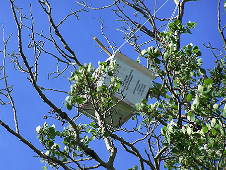
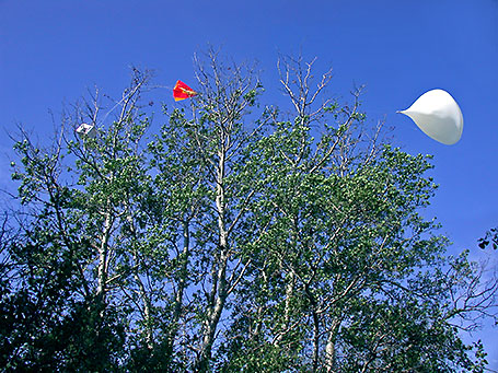
(left) Seeing the payload & antenna instantly answered why data transmissions were not received as 95% of the antenna element was missing. Only the small stub of brass tubing used to splice on the longer missing element remained which had snapped from stress as the antenna was dragged across the fields. |
 |
|||
|
|
||||
|
|
|
|||
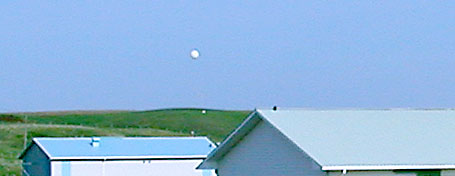
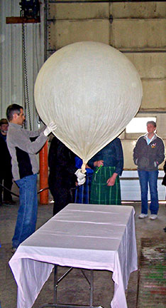 The balloon was launched at 8:09 AM after a 9 minute hold which wasn't bad considering Tony's students were doing most of the launch work and all of the questions, instruction and learning that took place. Time was also spent questioning if a launch
should even be attempted with the 40 km/hr winds that were gusting to 60 km/hr, but it was felt we had to at least try with the school term ending soon and this the only chance for some students to participate plus considering some of us traveled hundreds of miles to help. The wind wouldn't affect inflating the balloon with helium as
we had a large wash bay to do this in, but the question was how difficult handling an inflated balloon in the wind may be and what other problems the wind may cause.
The balloon was launched at 8:09 AM after a 9 minute hold which wasn't bad considering Tony's students were doing most of the launch work and all of the questions, instruction and learning that took place. Time was also spent questioning if a launch
should even be attempted with the 40 km/hr winds that were gusting to 60 km/hr, but it was felt we had to at least try with the school term ending soon and this the only chance for some students to participate plus considering some of us traveled hundreds of miles to help. The wind wouldn't affect inflating the balloon with helium as
we had a large wash bay to do this in, but the question was how difficult handling an inflated balloon in the wind may be and what other problems the wind may cause.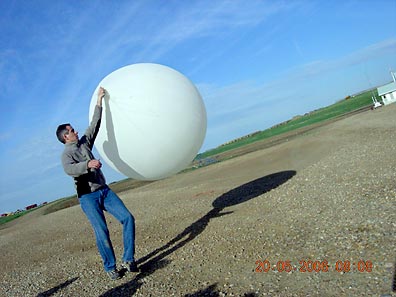 then expected and the photo taken at 8:08 by the payload camera of Tony with the balloon doesn't even come close to showing how difficult it was to keep the wind from blowing the
balloon about and into the gravelled earth repeatedly. Something had to be done quickly before the balloon was damaged so Tony released it while I held on to the payload and tried to move further away from the buildings with the hope the balloon would rise and stay out of the gravel. It sounded like a good idea at the time, but with
the balloon even less restrained at the end of a long leash the wind was now able to blow the balloon about even more wildly and harder down into the gravel.
then expected and the photo taken at 8:08 by the payload camera of Tony with the balloon doesn't even come close to showing how difficult it was to keep the wind from blowing the
balloon about and into the gravelled earth repeatedly. Something had to be done quickly before the balloon was damaged so Tony released it while I held on to the payload and tried to move further away from the buildings with the hope the balloon would rise and stay out of the gravel. It sounded like a good idea at the time, but with
the balloon even less restrained at the end of a long leash the wind was now able to blow the balloon about even more wildly and harder down into the gravel.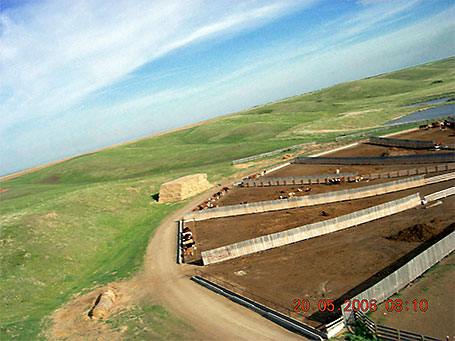
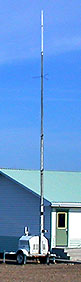 James brought and setup a portable APRS station and digipeater to allow the students to follow the progress of the balloon and ourselves as we tracked it and to help ensure we could receive each others data transmissions as the nearest other digipeater was
>100 miles away.
James brought and setup a portable APRS station and digipeater to allow the students to follow the progress of the balloon and ourselves as we tracked it and to help ensure we could receive each others data transmissions as the nearest other digipeater was
>100 miles away.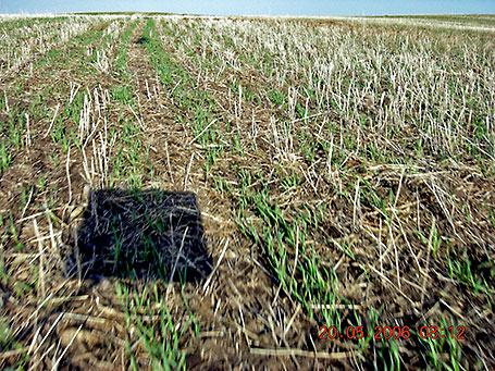

|
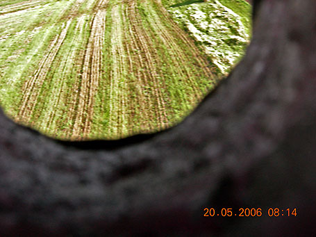
Even without GPS data, using Google Earth, land features and shadows it was possible to locate quite accurately where, and in which direction, 6 of the 8 payload photos were taken and determine SABLE-1's path, speed, distance travelled and what happened while SABLE-1 was out of view. If you have Google Earth installed, download SABLE-1.kmz and follow SABLE-1 from where it launched to where it became tangled up in trees and was recovered. If not, get & install it from Google Earth first. So why did SABLE-1 never get much higher than 100 feet? My first thought was that down drafts from the strong wind were the reason, but after writing the above and a lot of thought, I'm sure that if winds had been much lighter to permit the free lift to be confirmed outside after everything strung together and tied to the balloon, we would have found that it was much less than the 1 lb we thought it was. Different scales of unknown accuracy were used to weigh individual SABLE components and the weights were totalled, but scale accuracy errors and even small errors due to the rounding off of a number of individual weights all add up quickly. It would have been better to use a single scale of known accuracy for all measurements, but best is to simply weigh everything making up the balloon's load together, as a single item. And it's difficult to measure balloon lift using a scale and easier to simply add 1 lb, for free lift, to the weight the balloon must carry aloft, subtract the filling device weight, fill a plastic pop bottle with sand or water until it weighs the same as this result and tie the bottle to the filling device while the balloon is filled with helium. When the balloon, filling device and bottle all become neutral buoyant the balloon will contain the correct amount of helium. Update: Further information regarding free lift has been found.
I'm sure 40 km/hr winds would qualify as “high surface winds” and 200 to 300 grams is 7 to 10.5 ounces. This means out balloon only had 5 ounces more free lift then required to over come the effect of the wind if filled with the correct amount of helium to provide 1 lb of free lift and about 5 ounces of free lift is what the balloon appeared to have in the wind so I'm sure we had close to the 1 lb of free lift normally required and that our balloon would have surely overcome the terrain turbulence induced by high surface winds if we had known and provided an additional 200 to 300 grams of free lift. |
| sbszoo.com Main Home Page |
BEAR Home Page |
SABLE Home Page |
Amateur Radio Home Page |